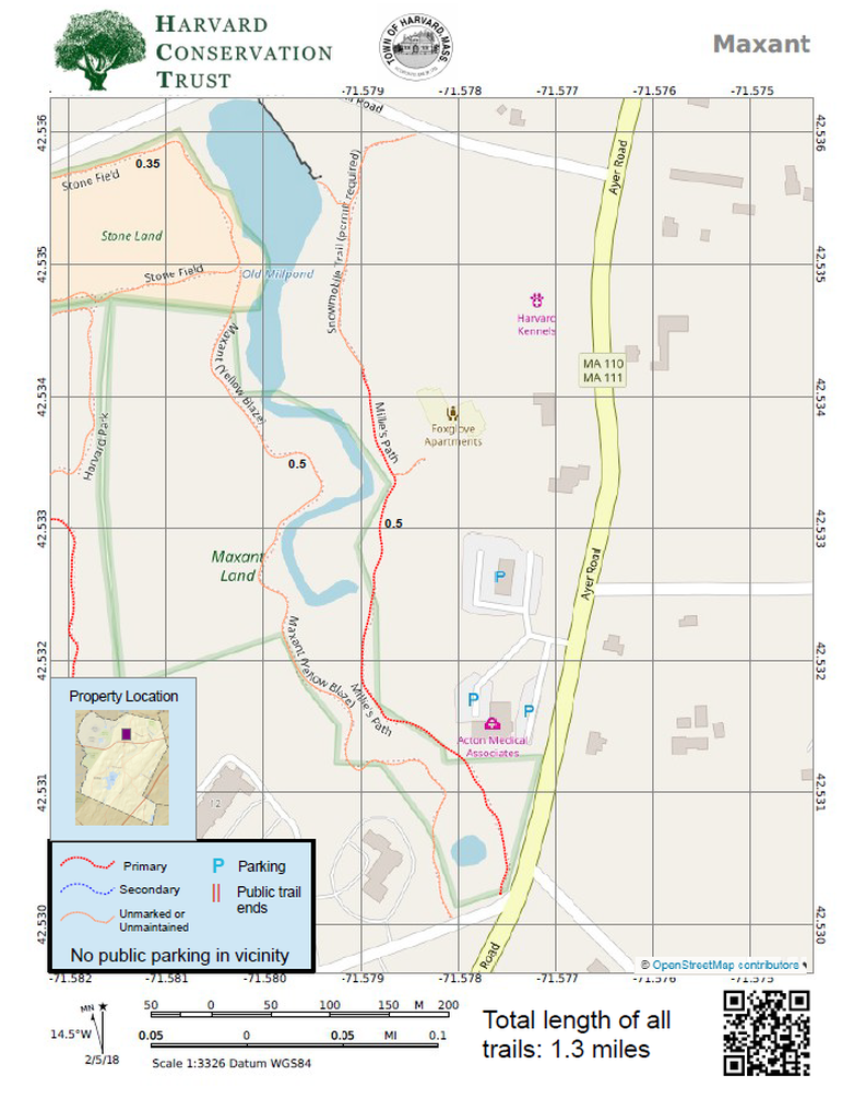
Map 4 - Maxant

Rating Comments: Millie's Path is wonderful. Packs a lot of beauty for such a small trail. The Bowers Brook is quite beautiful down a deep ravine, surprising given its proximity to Ayer Road. Nice wide path with pretty wooden bridges with benches for sitting. A real undiscovered gem. Loses a star for lack of parking. The trail on the west side of the brook is harder to find in spots (use the .gpx track!), but nicely connects to Stone's field and across to Harvard Park to extend the short walk through a variety of terrain, from deep woods and streams to open fields, to piney woods. Access from Foxglove Apartments. Millie's Path: Easy, Maxant Trail: Moderate/Difficult.
Trailhead Directions: Click here
Nearby Trails: Harvard Park
Parcel size: 19 acres
Prefer the classic hand-drawn map? Click Here
Conservation Land Use Rules: Click Here
Keywords: streams, longer walks possible, easy, benches
History: In 1987, this 19 acre property was a gift to the town from Theodore Maxant in exchange for permission to rezone a small piece of land from agricultural/residential to commercial.
Click here for a printable map.
Maxant PDF (321K)
Click Here for a downloadable GPX file to upload into your mobile mapping app.
