Map 30 - Hoch/Harris

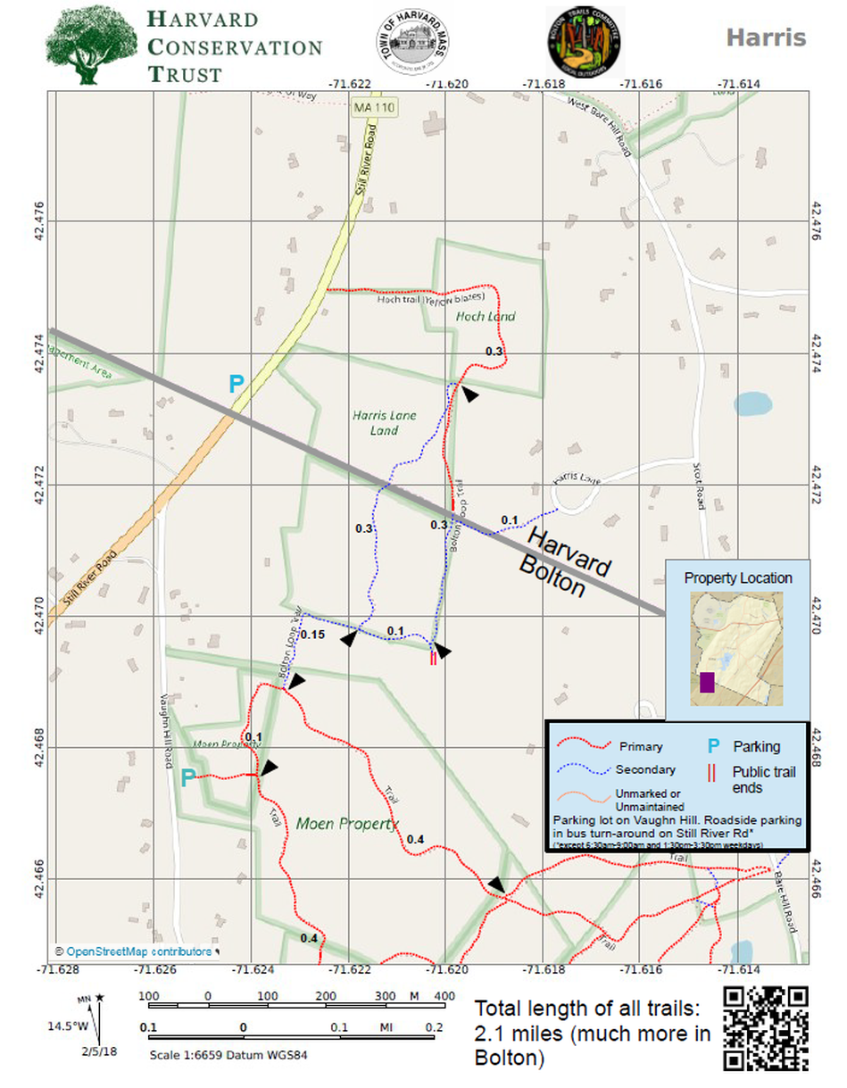
Rating Comments: Two access points in Harvard, one on Still River Road, the other at the end of Harris Lane. This trail would be worthwhile just for its Harvard portion, which passes through hardwood forest (and the dying vestiges of red pine plantation). What makes this new trail great is its connection to the Bolton Loop Trail through Vaughn Hills, 187 acres of hills, hardwoods, streams, and distant views. That greatly elevates the Harvard portion's modest trails into an amazing connection to a fantastic trail complex. Miles and miles of trails are available through this link. Inconvenient parking drops the rating one star. While parking is possible on Still River Road at the town line, that is also a school bus turnaround, so should be avoided around school bus hours. There is a signed public right-of-way that passes over private land at the end of Harris Lane adding another access point to the trail system. Easy-Moderate
Trailhead Directions: Click here
Nearby trails: Vaughn Hills
Parcel size: 28 acres (plus much more in Bolton)
Conservation Land Use Rules: Click Here
Keywords: long hikes possible, hills, streams, peaceful
Trailhead Directions: Click here
Nearby trails: Vaughn Hills
Parcel size: 28 acres (plus much more in Bolton)
Conservation Land Use Rules: Click Here
Keywords: long hikes possible, hills, streams, peaceful
Hoch history - The Hoch conservation restriction was granted to the Harvard Conservation Trust on December 30th, 2013. It covers 11.55 acres along Still River Road.
In June of 2011, an abutter alerted HCT that the property would be coming on the market. HCT contacted one of the beneficiaries and began negotiations.. HCT then contacted the Town of Harvard Conservation Commission to see if they would be interested in purchasing the land from HCT. HCT had to wait until the Commission voted to purchase at a December meeting before it could make a formal offer to the Hoch trust. Originally it was thought that the Commission would have to go to town meeting for final approval to purchase the land. It was subsequently determined that the Commission did not need to go to town meeting. HCT stepped aside so the Commission could negotiate directly with the Hoch trust, and the Town cam to agreement on price in early 2013. The purchase was completed in March of that year.
Harris history - The Harris Lane conservation restriction was granted to the Harvard Conservation Trust on April 3rd, 2000 by Harris Lane LLC. The land was later conveyed to HCT. The conservation restriction and conveyance of the property were required as part of the Town of Harvard’s approval of the Harris Lane Subdivision in April of 1998. The approval requires that the property be subject to a public access agreement for passive recreation. As part of the subdivision, Harris Lane LLC also donated an abutting 15.9 acre property in Bolton to the Bolton Conservation Trust. The permit approval also required a public access easement to the property along Harris Lane.
Click here for a printable map.
Hoch/Harris PDF (335K)
Click Here for a downloadable GPX file to upload into your mobile mapping app.
