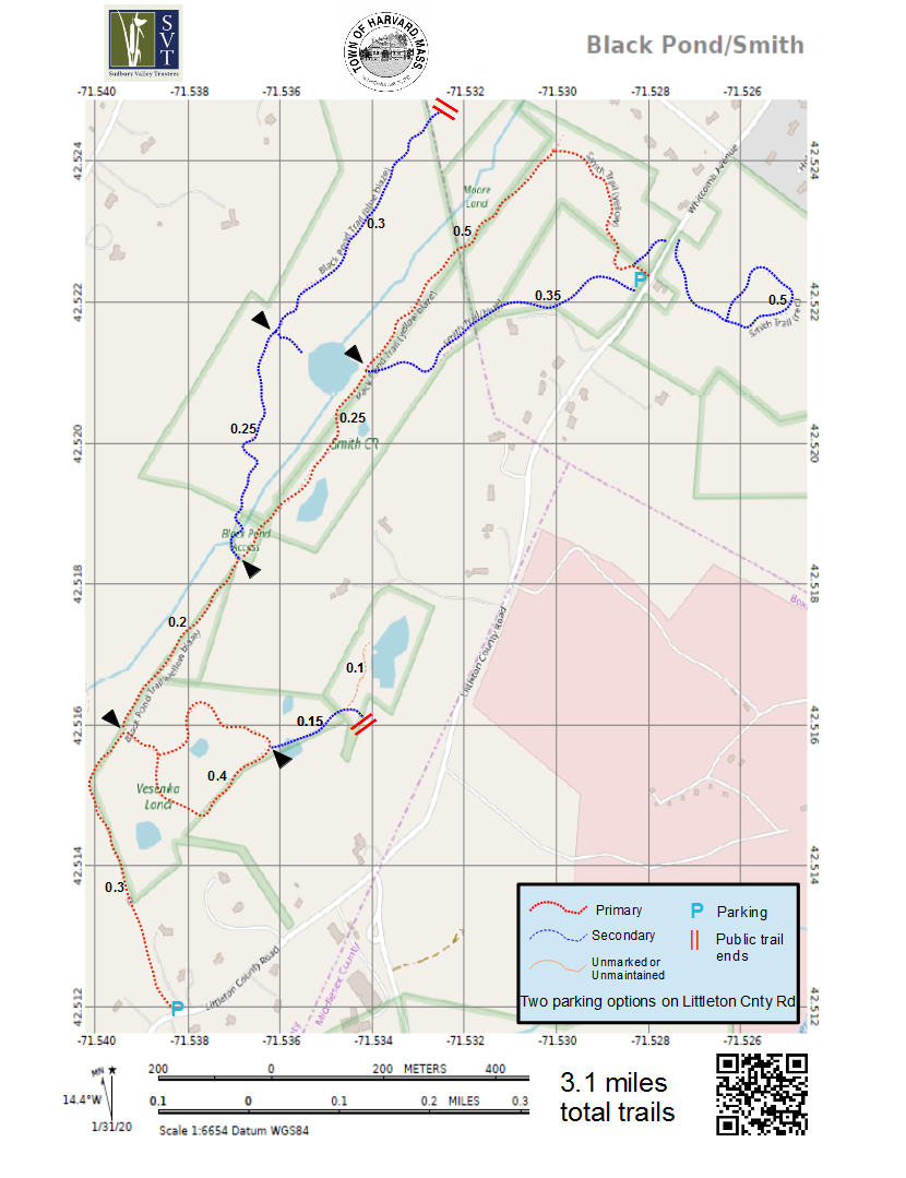
Map 11 - Black Pond

Rating Comments: Pull off the road at the Harvard trailhead, then head up the trail, over some boardwalks over wet areas, then turn right. Soon there will be a trail that goes off to the right forming a nice hilly loop through hardwood forest over the s0-called Vesenka Land. A short unmarked trail heads off the east end of the loop through pine forest to a feature called Marsh Pond. Back to the main Black Pond trail, there are two options. After a quarter of a mile, you can either stay take the secondary trail straight which traverses high on the narrow ridge overlooking Black Pond. Notice the unique marble underfoot in spots. Or you can take a sharp left through the stone wall then steeply down and over a stream which eventually merges with an old cart path. A spur off to the right takes you to Black Pond, where there is often beaver, otter, and good bird activity. You can then continue to the north where the trail joins the Smith Conservation Land in Littleton. Crossing Whitcomb Road in Littleton offers a small loop that skirts the extensive Beaver Brook Marsh. Moderate. The Sudbury Valley Trustees brochure and map can be found here
Trailhead Directions: There is now a parking lot and kiosk just over the Littleton line. Click here for directions to the new lot.
Elevation Gain: 150'
Parcel size: 142 acres
Prefer the classic hand-drawn map? Click Here
Conservation Land Use Rules: Click Here:
Keywords: geology, birds, pond, stream, hill, glacial boulders, hemlocks, peaceful.
Click here for a printable map.
Black Pond PDF (309K)
Click Here for a downloadable GPX file to upload into your mobile mapping app.
