Map 16 - Fruitlands

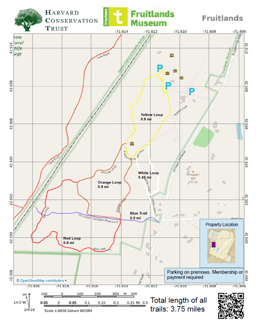
Rating Comments: A series of loop trails through a variety of terrain offers the hiking plenty of options depending on preference. Fruitlands puts in a lot of effort to maintain their trail system, with wide clean trails, beautiful wooden bridges, and interpretive signs. Well signposted to determine where the trail is, color-coded, and signs pointing out historically significant areas, such as the site of Clara Endicott Sears' "The Pergolas" site, and the Historic Willard Farm, as well as information about the nature of different land use patterns, succession, and Native Americans that once occupied the site.
Birders may wish to follow the Red Loop through the new meadow that is being managed for wildlife habitat and descends toward an area formerly used as a brickworks. The Yellow loop passes the former Willard Farm and an area where the Acotts lived after their failed Fruitlands experiment. It also passes through the beautiful old meadow with views to the west.. The Blue trail follows the historic Union Turnpike, a private toll road built in 1805 that took travelers to Leominster. It is used by members of the Harvard Snowmobile Club in winter and connects to miles of trails on adjacent Oxbow National Wildlife Refuge. The Orange Loop passes an area that was used by Native Americans for hunting and gathering.
The trails are open year round from 10 am to 5 pm during Museum Hours for hiking and cross-country skiing. All visitors are asked to park in designated parking areas and not along Prospect Hill Road. Use of the trails is a benefit of membership or is included the price of admission for museum visitors. Trail maintenance is supported through museum admissions, donations and memberships. Moderate.
Trailhead Directions: Click here
Nearby Trail: Oxbow
Elevation Gain: up to 443'
Parcel size: 208 acres.
Prefer the classic hand-drawn map? Click Here
Conservation Land Use Rules: Click Here
Keywords: Very long walks possible, historic interest, geology, fields, views, parking, wide, skiing, hills, wildlife, birds.
Click here for a printable map.
Fruitlands PDF (282K)
Click Here for a downloadable GPX file to upload into your mobile mapping app.
