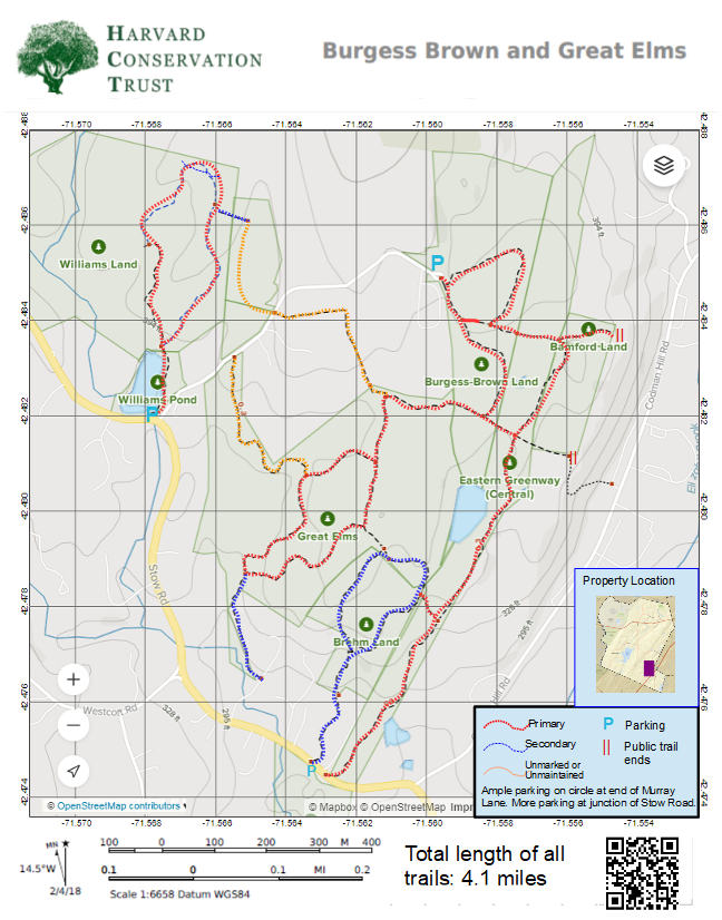
Map 27 - Burgess-Brown/Great Elms/Brehm/Eastern Greenway (Central)

Rating Comments: Park at the turnaround at the end of Murray Lane, and get access to 4+ miles of beautiful trails, extended by crossing over to the Williams Land. The short loop over the former Burgess farm land passes through an old meadow which contains vestiges of old apple trees. The trail enters the piney woods and passes by a spectacular glacial erratic, standing perhaps 15' tall and whose interesting shape triggers the imagination. Mysterious stone piles are found nearby and stone walls remind us how this forest was once farmed land. A secondary trail branches off of the loop at its southern-most point and provides access to the Great Elms land. The Great Elms loop has fun and interesting terrain with some short steep sections, ledges and boulders and vernal pools. The Brehm Loop has been restored. The Brehm land has steep sections with and rocky ledges in a mostly oak forest. With the recent acquisition of the Eastern Greenway, a new north/south trail runs along the eastern edge providing more connections and longer walking options. The new trail is steep in sections and passes two vernal pools through a very pretty forest. Note the "borrow pits" at the new trail access point on Stow Road, where gravel was mined during the construction of Rte 495. Depending on the weather, there may be some noise from Rte 495 along eastern-most section. Moderate.
Trailhead Directions: Click here
Elevation Gain: 275'
Nearby Trails: Williams
Parcel size: 117 acres
Prefer the classic hand-drawn map? Click Here
Conservation Land Use Rules: Click Here
Keywords: Parking, longer walks possible, glacial boulders, geology, ponds, birds, field, peaceful.
Trailhead Directions: Click here
Elevation Gain: 275'
Nearby Trails: Williams
Parcel size: 117 acres
Prefer the classic hand-drawn map? Click Here
Conservation Land Use Rules: Click Here
Keywords: Parking, longer walks possible, glacial boulders, geology, ponds, birds, field, peaceful.
Click here for a printable map.
Burgess-Brown, Great Elms PDF (1372K)
Click Here for a downloadable GPX file to upload into your mobile mapping app.
