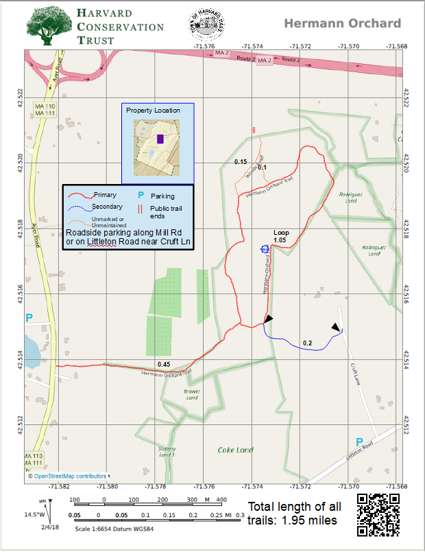
Map 10 - Hermann Orchard

Rating Comments: Former hilltop orchard affords 270-degree views of the hills and mountains to the west and north, providing enough return on the investment of getting here to make it all worthwhile. Two access options now exist. One involves parking along the north side of Mill Road, crossing busy and treacherous Ayer Road. The walk up the old access road from Ayer Road is easy and peaceful. The newer access, using the Crescent Valley Trail, requires parking on the roadside near the intersection of Cruft Lane and Littleton Road - near the Community Gardens provides the widest off-road parking. Then walk up Cruft Lane. Crossing the brook leads you onto private property. The public is allowed to walk on the driveway to the trailhead on the left side of the driveway. PLEASE STAY ON THE TRAIL. Note: No dogs or bikes are allowed on this linkage trail. This connecting trail will then cross over onto the town-owned conservation land, which has no restrictions on bikes or dogs. The trail then climbs to the north up the edge of the former orchard. The high point would make an excellent picnic spot. Moderate.
Trailhead Directions: Click here
Elevation Gain: 253'
Parcel size: 50 acres
Prefer the classic hand-drawn map? Click Here
Conservation Land Use Rules: Click Here
Keywords: Views, birds, hill, boulders, stream
History: The Hermann land was purchased by the Commission in 1976 as a working orchard. It has long been untended, and about half of the apple trees have been removed and converted to meadow.
Click here for a printable map.
Hermann Orchard PDF (307K)
Click Here for a downloadable GPX file to upload into your mobile mapping app.
